Data Products: Land surface albedo
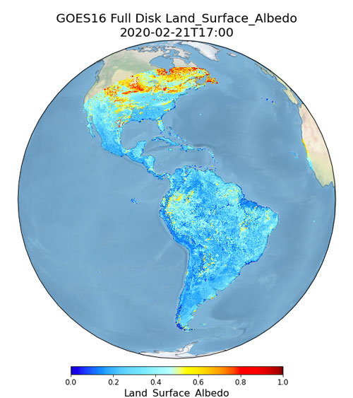
Land surface albedo (LSA) is defined as the ratio between outgoing and incoming irradiance at the earth surface. The LSA is a shortwave broadband blue-sky albedo over wavelengths between 0.4 and 3.0 µm. As the key component of surface energy budget, LSA can be used to drive/calibrate/validate climatic, mesoscale atmospheric, hydrological, and land surface models. Variation of LSA is also an important indicator of land cover and land use change. Analysis of long-term reliable albedo products will help better understand the human dimension of climate change and how the vegetation-albedo-climate feedbacks work. LSA is one of the Essential Climate Variables (ECVs) by the Global Climate Observing System (GCOS) of the World Meteorological Organization (WMO). The frequent temporal refresh rate, fine spectral resolution, and large spatial coverage make the Advanced Baseline Imager (ABI) a unique data source for mapping LSA.