Proving Ground: Overview
The Proving Ground is a collaborative effort between the GOES-R Series Program Office, NOAA Cooperative Institutes, NASA centers, National Weather Service (NWS) Weather Forecast Offices, National Centers for Environmental Prediction (NCEP), and NOAA testbeds across the country.
The Proving Ground is a project in which simulated GOES-R products can be tested and evaluated.
The Proving Ground was initially a pre-launch project to prepare users for the news types of data and imagery that would be available from the GOES-R Series. Now that GOES-R Series satellites are on orbit, work continues at the Proving Ground to use new capabilities to develop and test new products.
The Proving Ground was established to realize the benefits of the GOES-R Series system as soon as the satellites were launched and operational and has evolved to continue to explore the possibilities available from this new series of advanced satellites. These advances include improvements upon existing data such as increased spatial, temporal, and spectral resolutions for Earth monitoring and improved space weather observations and initiation of new operational observations such as lightning mapping.
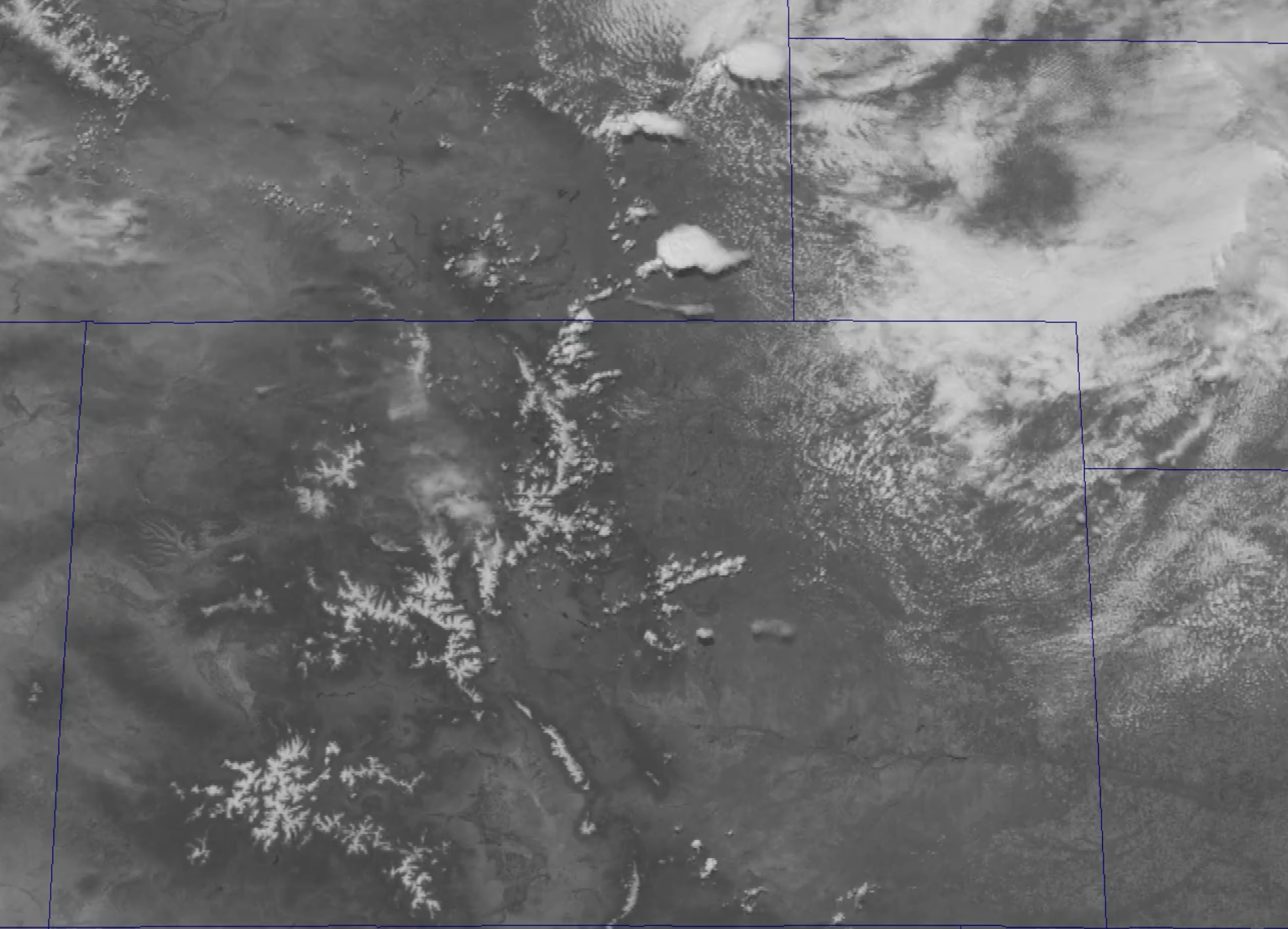
Many of the GOES-R Series products are aimed at monitoring severe weather and helping forecasters issue earlier, more accurate severe weather warnings. In order to create the most useful severe weather tools possible, the GOES-R Proving Ground works closely with the Experimental Forecast Program and the Experimental Warning Program of the NOAA Hazardous Weather testbed, developing and utilizing experimental GOES-R products to determine their utility in monitoring and forecasting severe convective weather.
Proving Ground Mission Statement
Various sizes can be downloaded from our logo page.
The GOES-R Proving Ground program was initiated to facilitate research-to-operations with the principal focus being on the forecaster/AWIPS-II environment; to prepare for GOES-R information, to get real-world experience by leveraging existing resources, and to evaluate product tailoring. The GOES-R Proving Ground engages the National Weather Service (NWS), Environmental Protection Agency (EPA), the Department of Defense (DoD), and other operational environments in pre-operational demonstrations of selected capabilities of next generation GOES with the objective to bridge the gap between research and operations by:
- Utilizing current systems (satellite, terrestrial, or model/synthetic data) to emulate future GOES-R capabilities;
- Infusing GOES-R-like products and techniques into NWS operations with emphasis on AWIPS-II;
- Engaging in a dialogue to provide feedback between developers and users.
The Proving Ground project engages the NWS forecast and warning community in demonstrations of capabilities available from the newest generation of NOAA geostationary Earth-observing systems.
The goals of the Proving Ground are: training forecasters to use new products, identifying different utilities of each product, identifying weaknesses or errors with each product, and user-feedback development.
The Proving Ground helped the GOES-R Program to ensure day-1 readiness and maximum utilization for both the developers and users of GOES-R products, and an effective transition to operations.
How does the Proving Ground work?
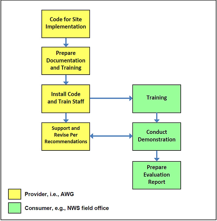
The Proving Ground works through providers and consumers:
Providers consist of NOAA Cooperative Institutes, a NASA Center, and NCEP National Centers under the direction of an Algorithm Working Group team lead. They prepare the product algorithms for implementation to the consumers.
Consumers consist of one or more NWS Weather Forecast Offices, NOAA testbeds, and/or NWS Regional Headquarters. They test, demonstrate, and prepare reports on the products designed by the providers.
The flow chart to the right shows this activity.
For More Information
- CIMSS GOES-R Proving Ground website
- CIRA GOES-R Proving Ground website
- NASA SPoRT GOES-R Proving Ground website
- Proving Ground demonstrations
- Proving Ground multimedia page
- Proving Ground partners page
- Proving Ground Products website
Fact Sheets
Blogs
- CIMSS Satellite Blog
- CIRA/RAMMB GOES-R Proving Ground Blog
- GOES-R Fog Product Examples Blog
- GOES-R/JPSS Satellite Liaison Blog
- GOES-R Proving Ground at the Aviation Weather Testbed Blog
- GOES-R Proving Ground at NOAA’s Hazardous Weather Testbed Blog
- GOES-R Tropical Pacific Proving Ground Blog
- It’s Severe: GOES-R/JPSS Proving Ground Blog
- The Wide World of SPoRT Blog